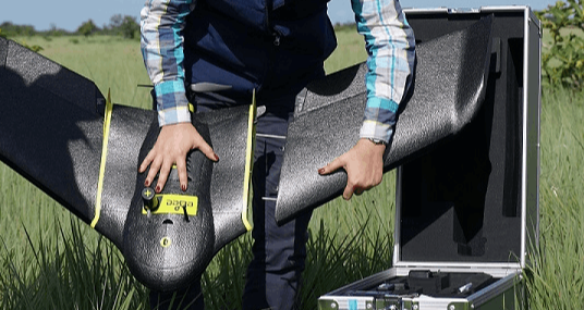
By means of photogrammetry techniques and images obtained by state-of-the-art unmanned aircraft, inputs are obtained for the visual and topographic identification of the terrain to be studied.
By means of photogrammetry techniques and images obtained by state-of-the-art unmanned aircraft, inputs are obtained for the visual and topographic identification of the terrain to be studied.
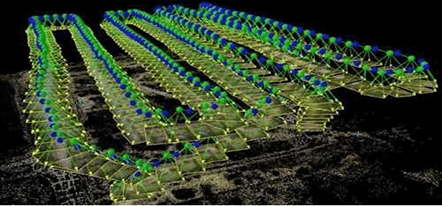
The equipment of the technological laboratory processes the information collected in the field by the unmanned aircraft, generating the products required for the rural and urban agro-industrial development of the territory.

From the geospatial information collected such as the ortho-photomosaic, the contour lines and the three-dimensional terrain models, the productive project is designed and planned on a study area.

The generation of products from the processing, analysis and interpretation of physical, hydroclimatic, cartographic, cadastral and legal inputs, allow us to obtain the diagnosis for making unequivocal decisions.
RUA ABOGADOS 2020